تخطَّ إلى المحتوى الرئيسي
Cairo University +20 2 35728232
Center of Hazard Mitigation, Environmental Studies and Research (CHMESR) Center of Hazard Mitigation, Environmental Studies and Research (CHMESR)
Geophysics & Geological Hazards Laboratory
الصفحات الرئيسية والفرعية (CMS Pages)

Geophysics & Geological Hazards Laboratory

Advanced geophysical surveys: Electrical Resistivity, Seismic Refraction, Ground Penetrating Radar (GPR), and geotechnical hazard assessments.

Geophysics & Geological Hazards Laboratory
Advanced geophysical surveys: Electrical Resistivity, Seismic Refraction, Ground Penetrating Radar (GPR), and geotechnical hazard assessments.

Geophysics & Subsurface Geological Hazards Laboratory

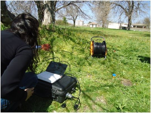
The Geophysics Laboratory executes precision engineering and geophysical surveys to evaluate development sites, detect subsurface karst sinkholes and fault zones, map groundwater tables, and mitigate geohazards and slope instabilities.

State-of-the-Art Methodologies & Applications:

  • Ground Penetrating Radar (GPR): High-resolution non-destructive imaging of subsurface voids, structural cavities, buried utilities, and tunnels.
  • 2D/3D Electrical Resistivity Tomography (ERT): Stratigraphic cross-section mapping, groundwater aquifer delineation, and soil salinity profiling.
  • Seismic Refraction & MASW: Determining P-wave and S-wave velocities to compute dynamic elastic moduli and foundation bearing capacity.
  • Flash Flood & Rockfall Risk Assessment: Geomorphological and hydrological modeling to safeguard national highways and critical infrastructure.

Core Geophysical & Engineering Geohazard Services

High-Resolution Ground Penetrating Radar (GPR)
Cavity & Void Detection

High-Resolution Ground Penetrating Radar (GPR)

Non-destructive subsurface radar scanning to detect cavities, karst sinkholes, buried utilities, and infrastructure foundations with ultra-high resolution.

  • Non-Destructive Void Scans
  • Utility Mapping
  • Deep Penetration Antennas
2D/3D Electrical Resistivity Tomography (ERT)
Stratigraphy & Hydrogeology

2D/3D Electrical Resistivity Tomography (ERT)

2D and 3D subsurface resistivity imaging mapping stratigraphic layers, groundwater aquifers, saltwater intrusion zones, and structural fault lines.

  • 2D/3D Imaging
  • Aquifer Delineation
  • Fault Line Mapping
Engineering Seismic Refraction & MASW Surveys
Engineering Seismology

Engineering Seismic Refraction & MASW Surveys

Determining primary and shear wave velocities (Vp & Vs) to compute dynamic elastic moduli and foundation bearing capacity conforming to Egyptian Seismic Building Codes.

  • Vs30 Velocity Profiling
  • Seismic Code Compliance
  • Dynamic Soil Moduli
Flash Flood & Rockfall Hazard Mitigation
Natural Disaster Mitigation

Flash Flood & Rockfall Hazard Mitigation

Hydrological and geomorphological catchment modeling to delineate natural flood runoff pathways, designing retention dams, and mountain rockfall slope stability analysis.

  • Flood Channel Mapping
  • Retention Dam Engineering
  • Slope Stability Modeling

Geophysics Laboratory Track Record

300+
Geophysical Surveys Delivered
GPR & ERT
Subsurface Imaging Technology
100%
Sinkhole & Flood Protection
35+
Years of Geoscience Expertise

أدوات الوصول

حجم الخط